
On December 5 and 6, South Baltimore got a sneak peek at the near-final plans for transforming the 11-mile shoreline of the Middle Branch into “Baltimore’s next great waterfront.”
In a pair of online public meetings, representatives of the “Reimagine Middle Branch” project laid out a detailed draft plan that is slated to go to the City’s Planning Commission in February. Public comments on this draft are being accepted through December 23 (see link below); additional opportunities for public input are being planned for January.
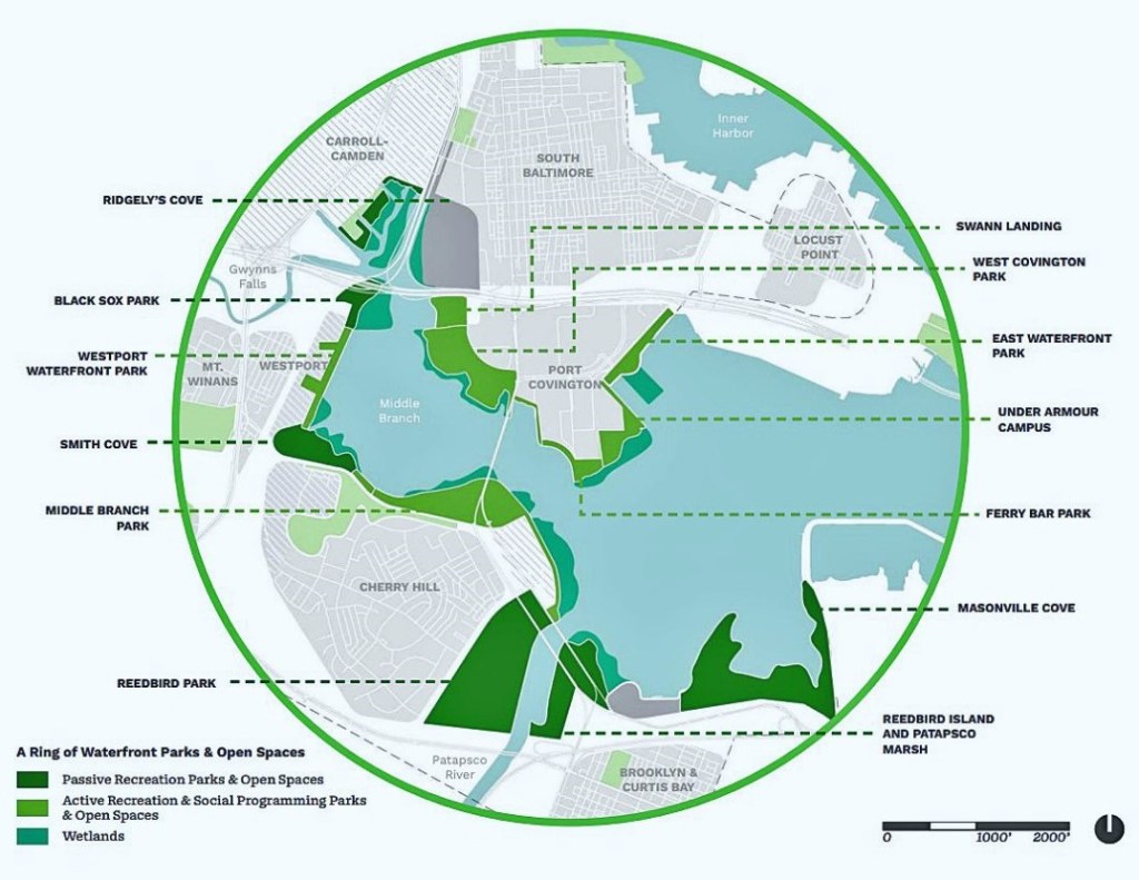
Over a decade in the making, the plan envisions a network of parks, recreational facilities, trails, and bridges that connect the 19 neighborhoods surrounding the Middle Branch of the Patapsco River with each other and with an improved “living shoreline” of wetlands and green space. A 20-year timeline is envisioned to complete the major elements of the plan.
The Middle Branch shoreline stretches from Brooklyn in the southeast to Westport and Ridgely’s Cove on the west and along the SoBo peninsula from Swann Park to the Port Covington Marina.
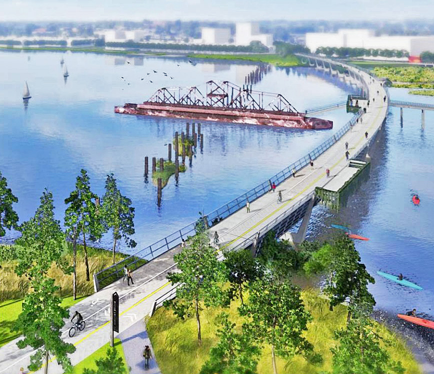
Highlights of the plan envisioned for the SoBo peninsula include the creation of a pedestrian bridge over Ridgely’s Cove from Westport to Swann Park, with boardwalk access to Sharp-Leadenhall, and the addition of pedestrian and bike lanes to the Hanover Street bridge.
The five-volume draft plan is available online as downloadable PDF files. Feedback can be submitted through December 23 via an online form.
The Reimagine Middle Branch plan is a collaboration between the City of Baltimore, South Baltimore Gateway Partnership, Parks & People, and leading designers. – Steve Cole


This is really encouraging to see! It is sorely needed and looks awesome! Thanks for this great article and the graphics.
LikeLike